Mapping and managing real world locations
Most organisations have places in the real world, such as offices, resellers, partners, event venues or other locations. But not many CMSs make it easy to manage them. This is where Zenario is a breath of fresh air.
Zenario's Location Manager allows site administrators to enter any number of real world locations. At its simplest, the site may just need to show the details of a single office or outlet, but the system will grow to whatever number of locations you need to display.
Easy to get started
Locations can be created in the Organizer admin back-end. Each one can be given an name, an address, and then plotted on a Google map. If the address isn't precise enough, the position of the pin can be adjusted manually.
Customisable fields
Locations are based on our Datasets system, so if the standard location template isn't quite right, it's easy to add more fields, such as for phone numbers, an image, URLs, checkboxes/flags, and categorisations.
It's even possible to define Sectors, and sub-sectors, so that on location-heavy sites (such as travel websites) you can put locations into broad or narrow groupings.
Front end interfaces
Depending on your needs, you can turn on the appropriate visitor interface.
For a single location, it's a simple task to drop a Google Maps Location onto a page.
Where there are a small number of locations to display, a Location Listing can be used, to show all locations in the database, or all locations matching some classification, such as those in a given sector, or country.
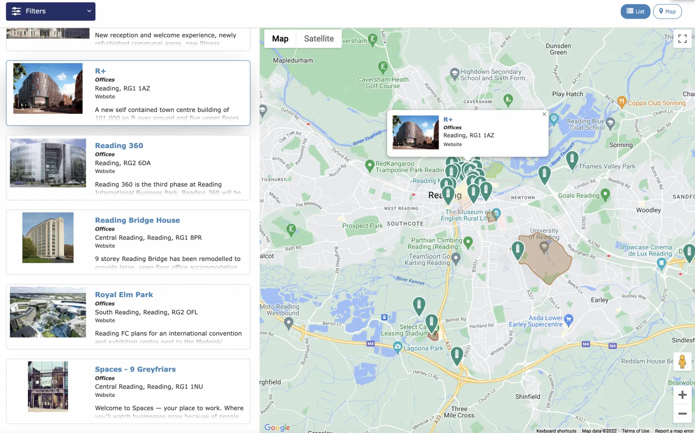
Where there are a larger number of places, a Location Map and Listing is available; this shows location pins on a map, together with a filterable list of the locations by name.

Polygon-based areas
Ever needed to display a coloured polygon on a map, to describe an area rather than a pin-point? It's easy. Zenario supports Areas, and it's easy to create an Area, find an approximate location, and then draw a polygon using a simple drawing tool.
Once done, the polygon just appears on a location map, as in the example above.

